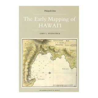
The cartographic history of Hawai‘i began with the arrival of Captain James Cook, the famous explorer and chart maker, in 1778. Between then and the mid-19th century, visitors to Hawai‘i produced a rich assortment of charts and maps depicting the shores, harbors, towns, and volcanoes of the various islands.
This volume traces the story of the mapping of Hawai‘i during the pivotal years in which the indigenous society was radically transformed by the peoples and ideas imported from the West. Foreigners introduced the concept of mapmaking to Hawai‘i, and they made maps of the islands to satisfy the needs of maritime commerce, missionary endeavors, and scientific investigations.
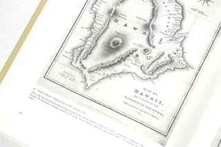
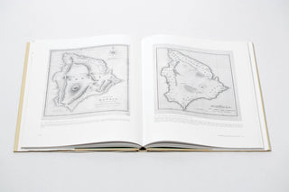
Nearly seventy maps, complemented by more than twenty views, portraits, and illustrations, are reproduced here. Included are many charts and harbor plans produced by such famous figures of naval history as James Cook, William Bligh, George Vancouver, Otto von Kotzebue, Urey Lisiansky, Jean Francois de la Perouse, Louis Duperrey, and Charles Wilkes. These richly reproduced charts document the early geography of Honolulu, Lahaina, Hilo, and Kailua—the most important urban areas of modern Hawai‘i—as well as many other bays and harbors in the islands.
A major segment of The Early Mapping of Hawai‘i examines the contributions of American missionaries in the field of mapping. Mostly produced at the seminary school at Lahainaluna, Maui, these maps introduced geographical education into the Hawaiian school system. The missionaries and their Hawaiian students also produced a landmark map of the islands in 1838, one of the most significant maps in Hawaiian history.
Hawaiian volcanoes have been the major laboratory for the study of volcanism for nearly 150 years. Reproduced in this volume are the earliest general and detailed maps of Kilauea, Mauna Loa, Haleakala, and the vestiges of volcanic features on O‘ahu.
Mr. Fitzpatrick examines the historic maps of Hawaiʻi from several perspectives. He discusses the people who made them, explains the collaborative process of making charts, interprets what the maps show, and relates the early maps to the documents which they accompanied. The mapping of Hawai‘i is shown to be an interesting and revealing part of the history of Hawai‘i.
The Early Mapping of Hawai‘i, was recognized as the outstanding book of 1985-1993 by Ka Palapala Po‘okela, the association of Hawaiian publishers, who honored it with the first Samuel Kamakau Award.
_____
Author Gary L. Fitzpatrick has worked in map libraries for more than twenty-five years. He studied geography at U.C.L.A. and library science at Catholic University of America. Mr. Fitzpatrick is currently the Specialist in Geographic Information Systems in the Geography and Map Division of the Library of Congress.
In addition to having written The Early Mapping of Hawai‘i he is also the author of International Time Tables, Direct-Line Distances, and numerous articles and bibliographies. He has taught courses in map librarianship and geographic information at the University of Hawaii and Northern Virginia Community College.
_____
hardcover | 160 pages | 9.5" x 10.5" | B&W


