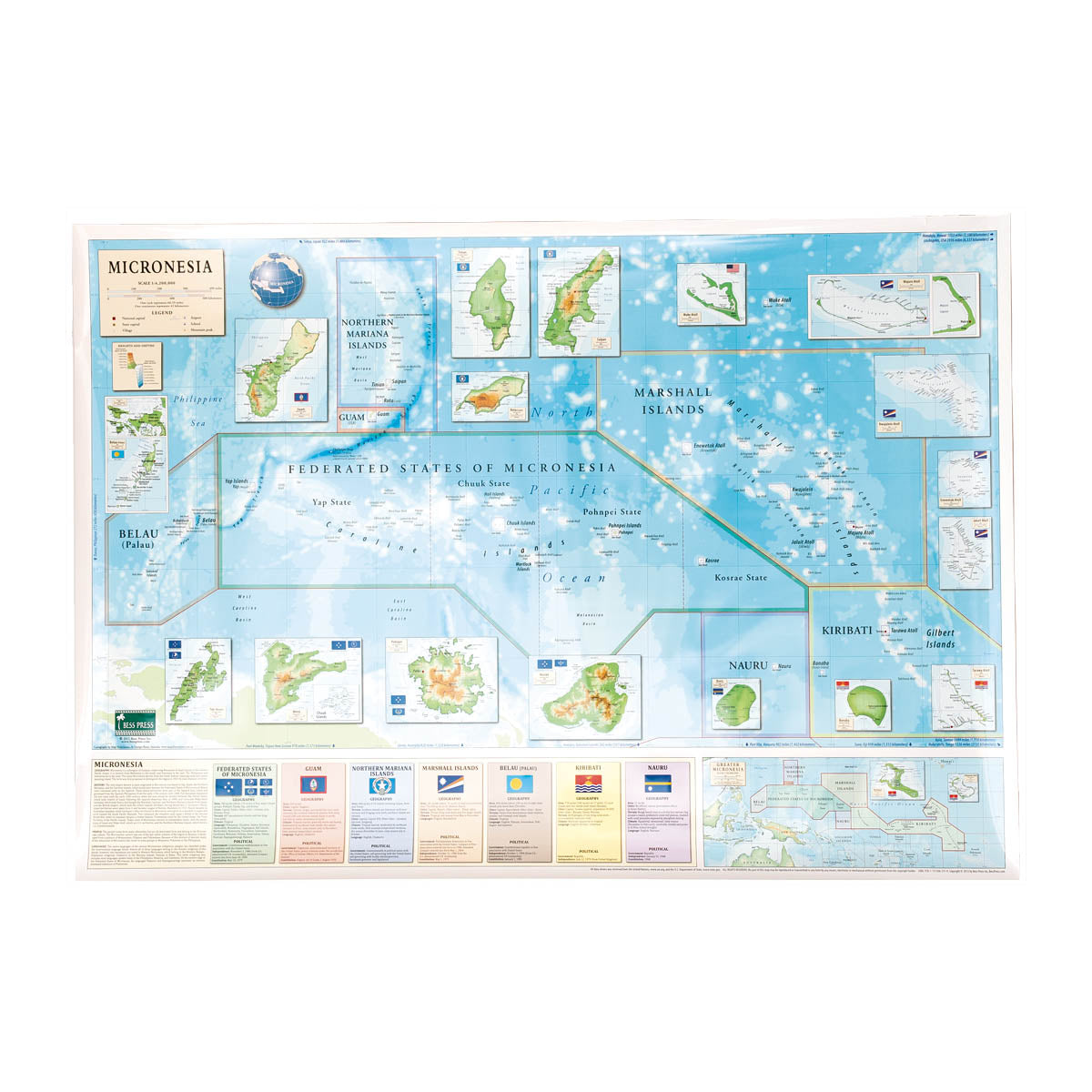
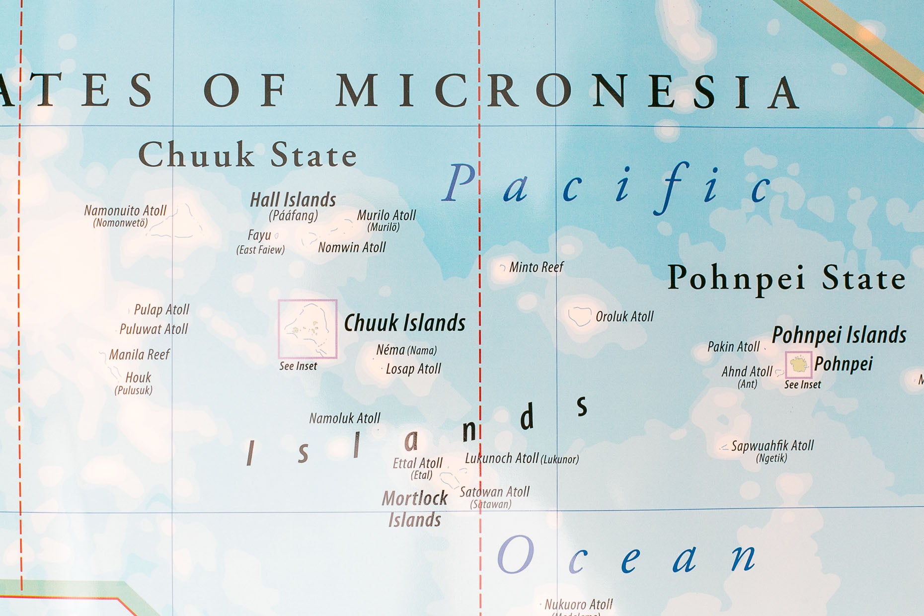
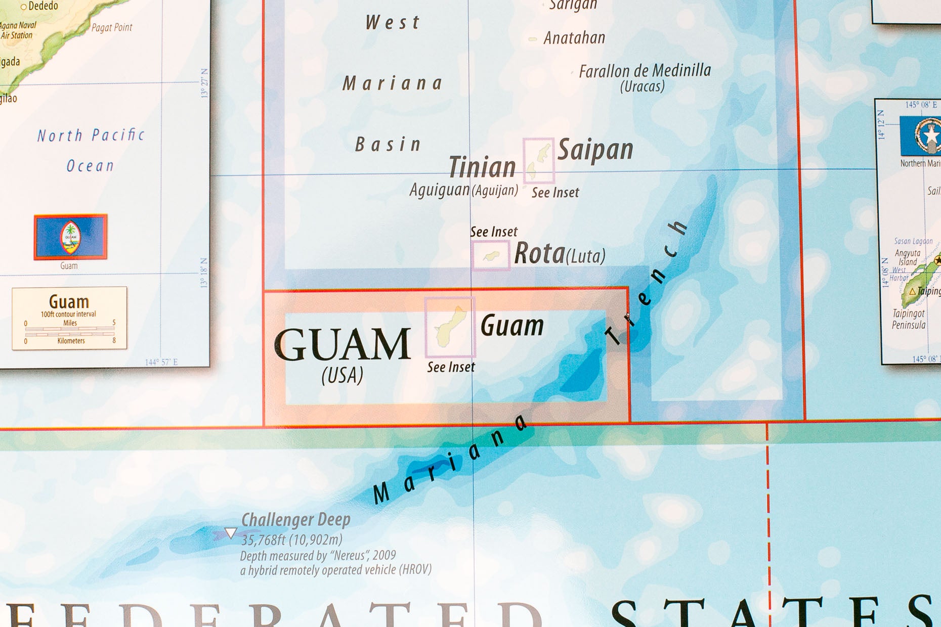
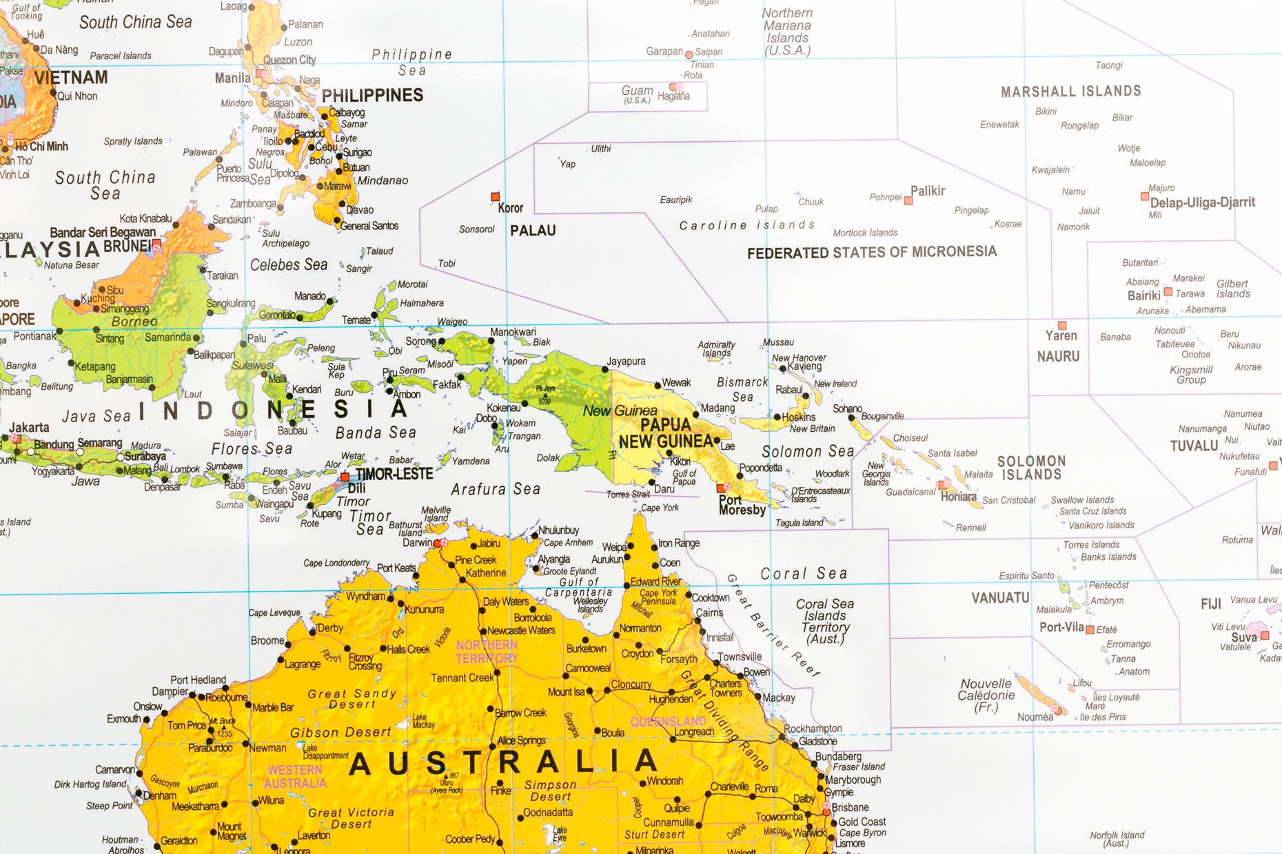
The Map of Micronesia is the premiere color map focused on one of the largest regions of the Pacific. Released in 2013, this map stands alone with its atlas and geographical approach of depicting the islands making up Micronesia. Each island section is enlarged with hi-resolution digital cartography of entire islands chains. Corresponding drop boxes detail the historical, political, economic, and general demographic information of all main islands.
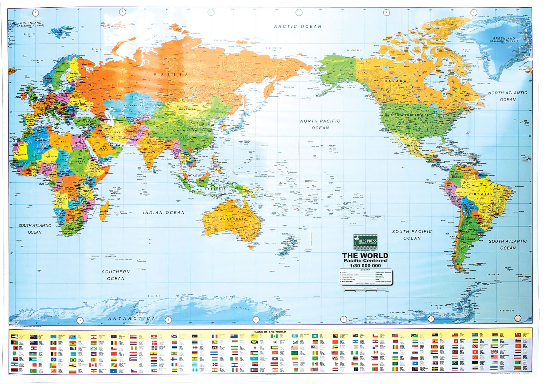
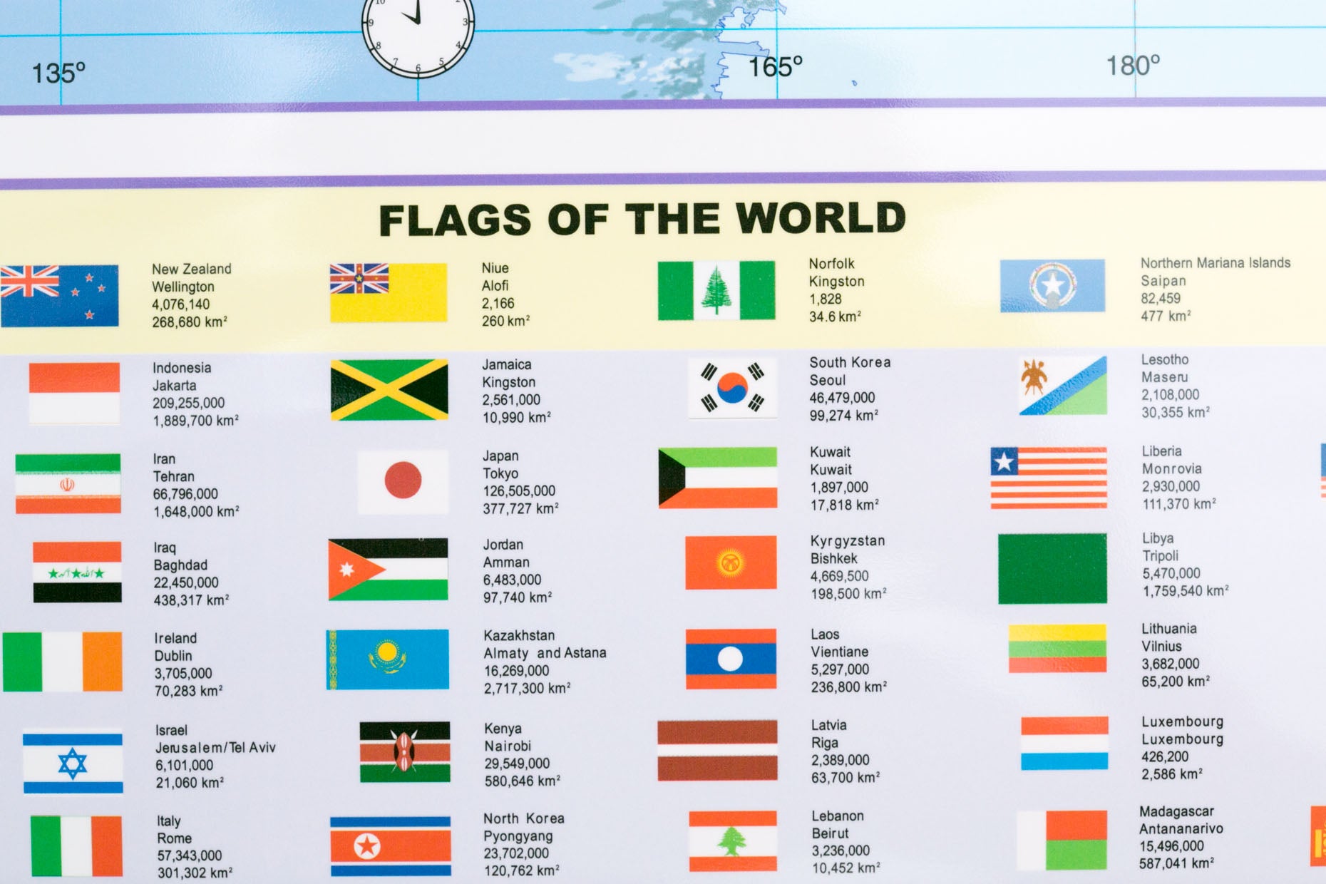
The Pacific-Centered World Map is the most up-to-date digital print map available for the classroom. This hi-resolution geographic visual places the world and the Pacific region within a global perspective. Double lamination enhances the durability and allows for mark-up with a dry eraser pen. Included are the flags from each of the Pacific nations and territories, as well as from countries around the world.
The double lamination applied to these maps allows for long-term durability and use in all climates. Graphics include hill shading and ocean shading to help explain the detail and variation of heights and depths.
Graphic features:
- Blow up inserts of main islands
- Available for the first time to educators in the Pacific
- Miller cylindrical cartography applied to create even and undistorted clarity
- Double lamination for durability and dry-erase marking
- Most up-to-date cartography of the world and the Pacific
- Includes flags of Micronesia
- Basic statistical facts of main islands
_____
spring roller | double lamination | 54" x 39" | color
The Map of Micronesia is the premiere color map focused on one of the largest regions of the Pacific. Released in 2013, this map stands alone with its atlas and geographical approach of depicting the islands making up Micronesia. Each island section is enlarged with hi-resolution digital cartography of entire islands chains. Corresponding drop boxes detail the historical, political, economic, and general demographic information of all main islands.
The Pacific-Centered World Map is the most up-to-date digital print map available for the classroom. This hi-resolution geographic visual places the world and the Pacific region within a global perspective. Double lamination enhances the durability and allows for mark-up with a dry eraser pen. Included are the flags from each of the Pacific nations and territories, as well as from countries around the world.
The double lamination applied to these maps allows for long-term durability and use in all climates. Graphics include hill shading and ocean shading to help explain the detail and variation of heights and depths.
Graphic features:
- Blow up inserts of main islands
- Available for the first time to educators in the Pacific
- Miller cylindrical cartography applied to create even and undistorted clarity
- Double lamination for durability and dry-erase marking
- Most up-to-date cartography of the world and the Pacific
- Includes flags of Micronesia
- Basic statistical facts of main islands
_____
spring roller | double lamination | 54" x 39" | color